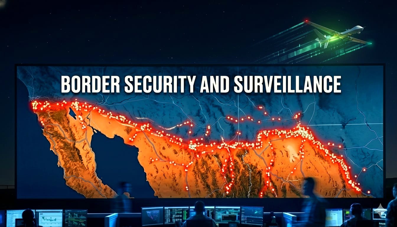
Border Surveillance Through Advanced Technologies
In an era where global mobility and geopolitical tensions demand robust enforcement of security and laws, border surveillance has evolved from traditional patrols to sophisticated, technology-driven systems. This blog explores how authorities can leverage long-range hybrid drones and mobile network tracking to monitor and secure borders and restricted areas effectively. By combining aerial real-time intelligence with passive device detection, these methods provide a comprehensive approach to detecting unauthorized movements. We’ll also discuss how partnering with Hacom Technologies can customize these solutions to meet local regulatory and operational needs.
Long-Range Hybrid Drones: Eyes in the Sky for Extended Surveillance
Long-range hybrid drones represent a leap in unmanned aerial vehicle (UAV) technology, blending gasoline engines for endurance with electric motors for efficiency and quiet operation. These drones can fly up to 200km (124 miles) from their base station while maintaining continuous operation for over 8 hours, far surpassing battery-only models. Equipped with high-resolution cameras, thermal imaging, and AI-driven object detection, they transmit real-time video back to ground controllers via secure, long-range data links (up to 200km line-of-sight or beyond with relays).
In border security, these drones patrol vast, remote areas autonomously or semi-autonomously, identifying suspicious activities like unauthorized crossings or smuggling. For instance, they can hover at high altitudes (up to 5,000m) to avoid detection while streaming 4K video feeds, enabling operators to zoom in on targets and relay coordinates to ground teams. Their hybrid power systems ensure reliability in harsh environments, such as deserts or mountainous borders, where recharging isn’t feasible.
This capability enforces laws by providing irrefutable evidence for interventions, reducing the need for constant human presence and minimizing risks to personnel.
Mobile Network Tracking: Detecting Movements Through Invisible Signals
Even when mobile phones cannot connect to a network, such as in remote border zones or when roaming is disabled, they remain “visible” to mobile infrastructure. Phones constantly scan for available networks by sending probe requests and registration attempts, which are detected by base stations (eNodeBs in LTE/5G) and forwarded to the Mobility Management Entity (MME) in the core network. The MME tracks these signals via temporary identifiers (e.g., GUTI) or IMSI if caught, allowing operators to count and approximate locations through cell tower triangulation (accurate to 100-300m in rural areas).
This passive detection works because phones in idle mode perform cell selection/reselection to find the strongest signal, emitting radio bursts that reveal their presence without a full connection. Authorities can deploy monitoring systems like IMSI catchers or integrate with MNOs to map device density and movements. While individual ownership isn’t identifiable without warrants, the sheer number of devices signals human activity, e.g., a sudden cluster in a restricted zone indicates potential border crossers. This enforces security laws by alerting patrols to anomalies, even for “burner” phones or those in airplane mode (though airplane mode disables radio, most users keep it off).
Combining Drones and Mobile Tracking: A Synergistic Approach to Border Monitoring
The true power of border surveillance lies in integrating long-range hybrid drones with mobile network tracking. Drones provide visual confirmation and real-time pursuit, while network data offers passive, wide-area detection of movements before visual contact. For example, if MME data shows an unusual concentration of phones (e.g., 50+ devices in a 1km² desert area), authorities can dispatch a drone to fly 100km out, hover for 8 hours, and stream video feeds identifying groups or vehicles.
This combination excels in tracking across borders: Network signals reveal migration paths (e.g., via device counts along routes), triggering drone deployments for detailed reconnaissance. AI on drones can correlate video with signal data, estimating group sizes or spotting hidden individuals. In restricted areas, persistent drone overwatch combined with signal mapping enforces laws by enabling rapid interdictions, evidence collection for prosecutions, and even non-lethal deterrence (e.g., audible warnings). This hybrid system minimizes false positives, respects privacy through aggregated (not individual) tracking
Mobile phone behavior: what can be ‘seen’
- Why phones keep “looking for networks”
3GPP defines PLMN selection behavior in idle mode, including PLMN selection, higher‑priority PLMN search, and background search, and it explicitly accounts for conditions like loss of radio coverage and recovery. This is why devices near borders may oscillate between home and visited networks, and why roaming conditions can drive repeated “try/register/fail” cycles in fringe coverage. - When the core network can “see” a device
In LTE/EPC, when a UE can proceed to attach, it initiates the attach procedure by sending an Attach Request that may include identifying information (e.g., IMSI or old GUTI) plus mobility context (e.g., last visited TAI if available). - Critical limitation: if a handset is powered off, in strict airplane mode, shielded, or truly out of radio coverage, it will not generate network‑visible signaling.
Location granularity and “counting”: what is realistic
- Granularity is typically “area‑based” unless the device is active.
In LTE/EPC, the network uses a tracking area list concept: when the UE registers, the MME allocates a list of Tracking Area Identities (TAIs) to reduce frequent updates by keeping the list centered around the UE’s location - Counting devices is not the same as counting people.
Core events can support device‑level analytics (e.g., scaling anomalies, surges in attach/registration attempts, roaming failure patterns) but do not, by themselves, yield a reliable “number of persons,” because (a) people may carry multiple devices, and (b) a single device may generate multiple signaling events during retries or mobility edge cases.
Operational workflow: detect → verify → track → respond
A realistic two‑sensor program succeeds by treating the mobile network as an early‑warning and prioritization layer, and drones as the verification and continuous tracking layer.
-
Detect
Detection can start from anomalous device presence signals near a border/restricted boundary (e.g., sudden increases in roam/registration attempts, shifts in aggregate device presence across tracking areas). This relies on lawful network data availability and should default to aggregated indicators where possible.
-
Verify
Verification is the step that prevents the program from degenerating into false positives: Drone EO/IR video confirms whether an alert corresponds to people/vehicles/animals, and whether the movement is consistent with a policy concern.
-
Track
Tracking is fundamentally a handoff problem: Drones track continuously while there is visual contact; endurance constraints mean you need defined criteria for handover (to another drone, to ground patrol, or back to network‑only monitoring).
-
Respond
Response should be routed through lawful command structures: – Dispatch decisions should be documented and audited. – Escalation should require a higher authorization threshold and explicit legal basis.
Location data is highly regulated personal data
In the EU framework, location data is explicitly an identifier within the definition of personal data, and profiling can include analysis of a person’s “location or movements.” Separately, the ePrivacy Directive constrains “location data other than traffic data,” generally requiring anonymization or consent and limiting processing to what is necessary for the value‑added service.
The European Data Protection Board emphasizes preference for anonymised location data and reiterates that location data held by electronic communication providers is processed under ePrivacy/GDPR constraints and typically may be transmitted to authorities only if anonymised (or under tightly defined legal conditions).
“Mass retention” and indiscriminate collection risk legal invalidity
European case law and related Court communications have repeatedly stressed that general and indiscriminate retention/transmission of traffic and location data is incompatible with EU law, while allowing narrow, time‑limited exceptions under stringent safeguards (e.g., serious threats, targeted retention, effective review).
In the U.S., the Supreme Court held that government acquisition of certain historical cell‑site location records is a Fourth Amendment search, underscoring that network location datasets are often treated as constitutionally sensitive.
Partnering with Hacom Technologies: Tailored Solutions for Local Needs
Authorities seeking to implement these advanced surveillance systems can partner with Hacom Technologies, a leader in integrated security solutions. Hacom customizes deployments to local regulations, ensuring compliance with privacy laws -like data protection norms- by integrating hybrid drones with secure MNO APIs for signal tracking. Their experts handle setup, training, and maintenance, adapting to terrains like coastal deserts or mountainous borders. Whether for national security, anti-smuggling, or humanitarian monitoring, Hacom acts as a reliable ally, delivering scalable, ethical solutions that enhance enforcement while respecting sovereignty. Contact Hacom today to explore how we can secure your borders effectively.